


J1 RANDO SPORTIVE VERDON

CASSISFRAMBOISE
User

Length
14.8 km

Max alt
1395 m

Uphill gradient
918 m
Km-Effort
27 km

Min alt
697 m

Downhill gradient
918 m
Boucle
Yes
Creation date :
2022-02-21 17:38:07.528
Updated on :
2022-02-21 17:38:46.201
6h09
Difficulty : Medium

FREE GPS app for hiking
 SityTrail
IGN / Geographical institutes
SityTrail Plus
The world is yours!
About
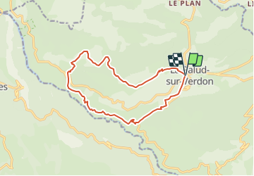
Trail On foot of 14.8 km to be discovered at Provence-Alpes-Côte d'Azur, Alpes-de-Haute-Provence, La Palud-sur-Verdon. This trail is proposed by CASSISFRAMBOISE.
Positioning
Country:
France
Region :
Provence-Alpes-Côte d'Azur
Department/Province :
Alpes-de-Haute-Provence
Municipality :
La Palud-sur-Verdon
Location:
Unknown
Start:(Dec)
Start:(UTM)
285912 ; 4850829 (32T) N.
Comments